A COMPARITIVE OVERVIEW
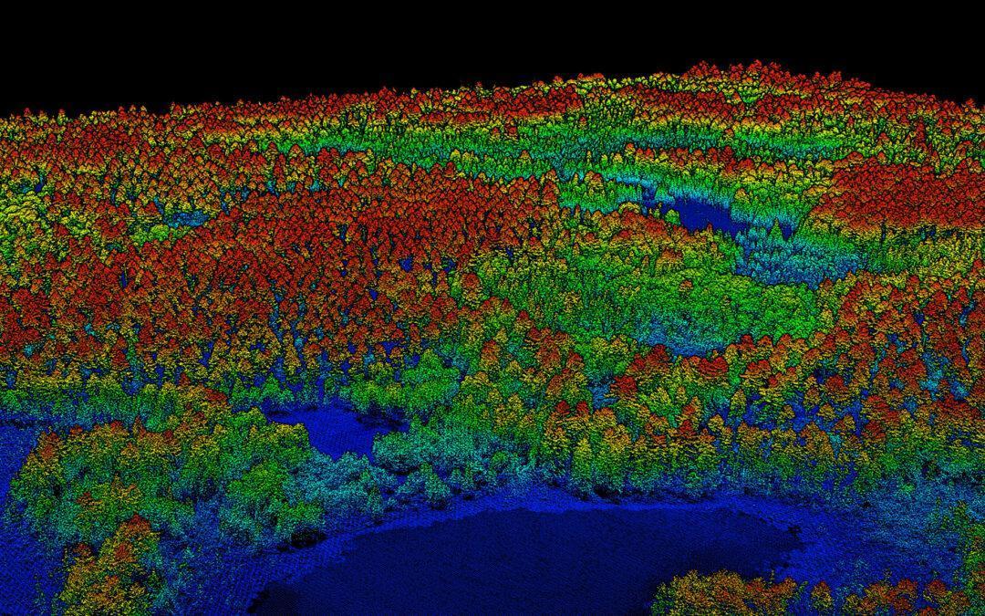
Over the past 20 years, LiDAR technology has revolutionized the way we observe and describe forest structure. LiDAR (light detection and ranging) is a precision tool for characterizing the three-dimensional distribution of vegetation. It is an active remote sensing technique that measures distances with a very high accuracy by emitting laser energy and analyzing the backscattered energy as a function of time. In this article, we present the main types of LiDAR systems (ground and airborne) and highlight the opportunities and challenges associated with their use. VIEW HERE